


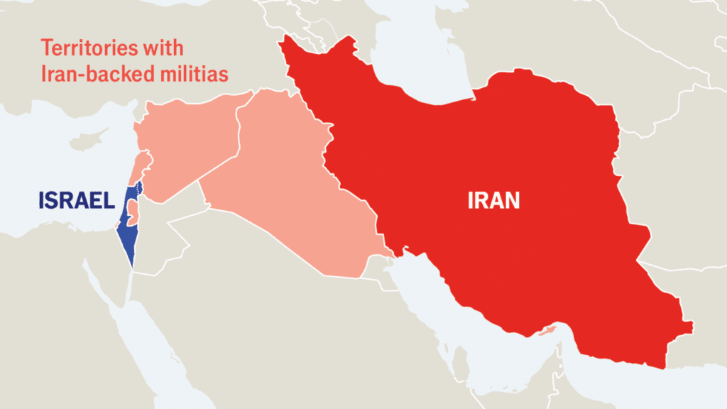
The escalating US-Israel-Iran war has unfolded rapidly across the Middle East, with airstrikes, missile launches and drone attacks reshaping the region within days. Interactive maps, satellite images and before-and-after visuals illustrate the scale, precision and regional impact of the fighting between the United States and Israel on one side and Iran and its allied groups on the other.
Airstrikes leveled entire compounds and urban blocks, while missiles crossed borders and drones struck strategic targets. Visual evidence highlights how the conflict has expanded geographically and intensified militarily, making maps and graphics crucial tools for understanding the fast-moving developments.
US-Israel-Iran war visuals
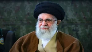
One of the most dramatic visuals captures the destruction of the compound belonging to Iran’s Supreme Leader, Ali Khamenei, before and after the February 28 strikes. The attack reportedly killed Khamenei along with other senior Iranian leaders, dealing a severe blow to the country’s theocratic leadership. Satellite imagery shows that aircraft struck the compound with pinpoint accuracy, reducing it to rubble while leaving several surrounding buildings largely intact.
The conflict has also triggered political uncertainty within Iran. Analysts have identified potential successors to Khamenei, including former President Hassan Rouhani, known for negotiating the landmark nuclear deal with the Obama administration; Mojtaba Khamenei, the slain leader’s son; and Hassan Khomeini, grandson of revolutionary leader Ruhollah Khomeini. Each candidate represents a different direction for Iran’s religious and political future.
Also Read : Melania Trump Chairs UN Meeting Amid Iran Strikes
Beyond leadership turmoil, the war has rattled global energy markets. Oil prices surged in the days following the initial strikes. U.S. crude rose above $70 per barrel, reaching its highest level since July, when a previous 12-day Israel-Iran confrontation temporarily pushed prices close to $75. Traders continue to react to every escalation, as instability in the Persian Gulf directly affects global supply expectations.
Naval deployments have further intensified tensions. Maps tracking U.S. military assets show destroyers positioned strategically across key waterways under the direction of the Trump administration. Control of maritime routes remains central to the broader regional strategy.
Through maps, graphics and satellite imagery, the US-Israel-Iran war becomes clearer: a fast-moving, high-impact conflict reshaping political leadership, military strategy and global markets simultaneously.
Also Read : Dubai Safe Haven Status Shaken After Iranian Missile and Drone Attacks


More Stories
खामेनेई की मौत के बाद भारत क्यों साधे हुए है चुप्पी
कैच: अक्षर पटेल-शिवम दुबे की शानदार जुगलबंदी, गंभीर का रिएक्शन वायरल
“कुर्द हमारी लड़ाई नहीं लड़ेंगे”: इराक की फर्स्ट लेडी की बड़ी अपील